
wincan integration
Software
End-To-End Solution For Wastewater Inspection And Management
Make sewer inspections safer, faster, and less expensive. Collect visual data inside sewer pipes, import that data directly into WinCan’s sewer inspection softwares, process it, analyse it, and create detailed, standards-compliant reports.

Embrace drone technologies as part of your work
This software tailored for industry professionals allows you to gain piloting skills without the potential risks and costs associated with real-life training.
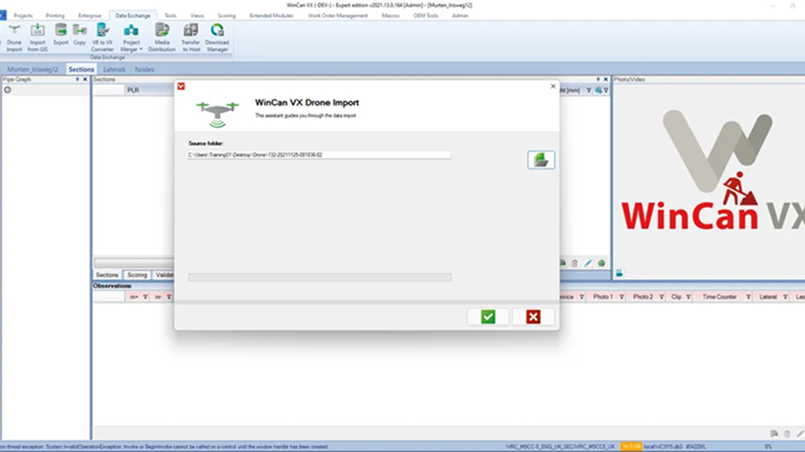
Data importation
Easily import inspection data captured with the Elios 2 and processed with directly into WinCan VX and WinCan Web. The import functionality recognises Flyability file format and parses it to extract all the information needed to import all points of interest, pictures, and video. Observation distances and section length are automatically calculated from the trajectory file.
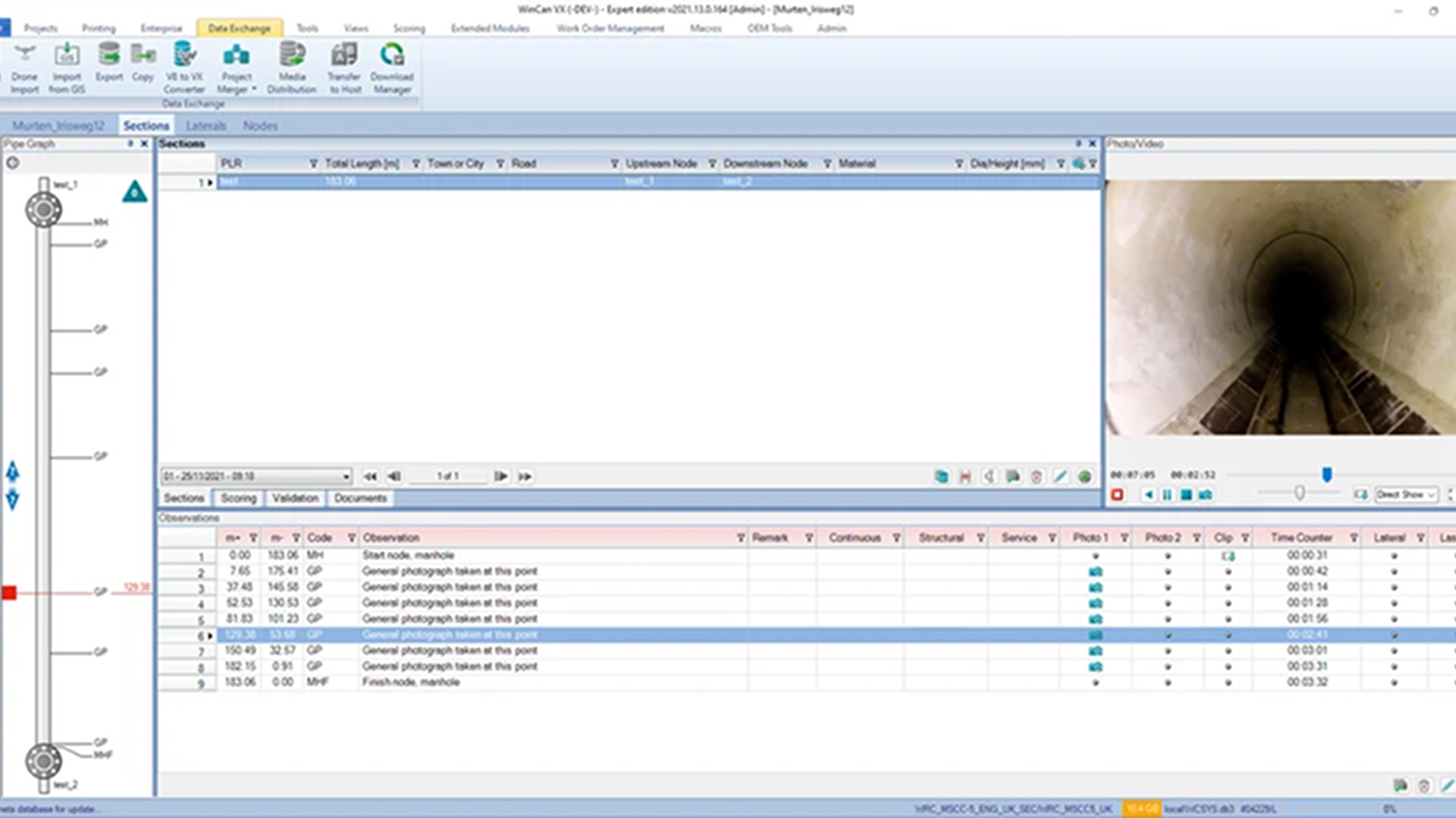
Document your point of interests
Once the data is imported you can find all your points of interest in WinCan’s software along the inspected sewer section. Observation distance is indicated relatively to the starting point of the sewer section.
All the information you entered in Inspector 3.0 when reviewing points of interest is automatically imported into observation points in WinCan’s software. You can then work as usual on your WinCan project to finalize your inspection. If you add more observation points, distance from the beginning of the sewer section is calculated automatically.
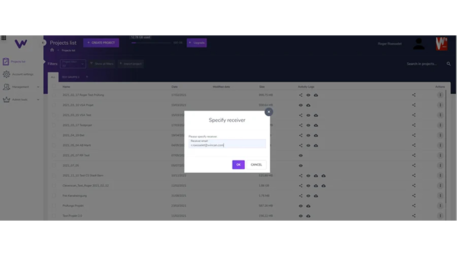
Share Your Data
All the data is fully compatible with WinCan Web. Data can be uploaded to WinCan Cloud at the push of a button and shipped to your end customer.
Q&A
Most drones commonly used outdoors rely on GPS signals for localisation and stability. However, they face challenges when operating indoors or in confined spaces due to the lack of GPS availability in these environments. In contrast, specialized drones like the Elios 3 are designed for GPS-denied environments, offering reliable localisation and stability without the need for GPS. These drones are specifically engineered to navigate in challenging conditions, such as dark, dusty, and confined spaces.
The Elios 3 is built for contact during flight, featuring a lightweight carbon-fiber cage that provides impact protection when the drone comes into contact with walls or structures. Additionally, the drone is equipped with bi-directional rotors, enabling it to autonomously flip back into an upright position mid-flight, even if it is toppled.
The Elios 3 is equipped with a 'Return-to-Signal' (RTS) safety feature that activates automatically if the connection with the remote control is lost. In RTS mode, the drone can autonomously retrace its flight path, returning to the takeoff point or continuing its flight until the connection with the remote control is restored.
The Elios 3 is equipped with an onboard LiDAR module that generates a real-time 3D map or model of the environment it is flying through. This enhances both the pilot’s situational and locational awareness while navigating the drone in confined spaces. The 3D map is also invaluable for identifying and localizing Points of Interest (POIs), such as defects detected during inspection flights. Additionally, the Elios 3 serves as a Scan-to-BIM tool, allowing the 3D model of the space to be used for creating BIM models and performing volumetric measurements.
The Elios 3 is designed with modular payload integration in mind. Currently, available optional payloads include the Radiation Detection Payload, UT Gauging Payload, Surveying Payload, and Flammable Gas Detector Payload. Additional payloads will be introduced progressively to expand its capabilities.
Request a Demo
Would love to see a demo? Share your contact details with us and our team will reach out to you shortly.